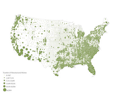
Energy Insecurity in the SouthThis ArcGIS StoryMap, developed for the Southeast Energy Efficiency Alliance, uses current data to provide an overview of the landscape of energy access and affordability for low-income people and communities of color in the eleven states of the Southeast.
|
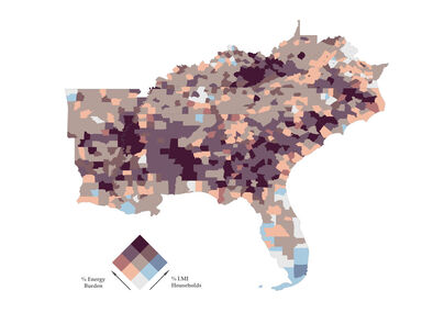
Energy Insecurity in the SoutheastThis ArcGIS StoryMap, developed with the Southeast Energy Efficiency Alliance (SEEA) and Texas Energy Poverty Research Institute (TEPRI), uses current data to provide an overview of the landscape of energy access and affordability for low-income people and communities of color in the twelve states of the South.
|

Energy Insecurity in MemphisThis ArcGIS StoryMap, developed for the Southeast Energy Efficiency Alliance, uses current housing and energy data to provide an overview of the landscape of energy access and affordability for low-income people and communities of color in Memphis, Tennessee.
|
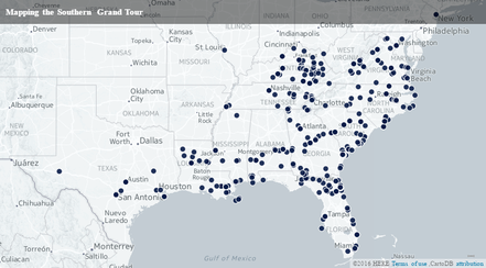
Traveling SouthThis ongoing peer-reviewed digital project, produced in partnership with the Emory Center for Digital Scholarship (ECDS), provides a unique view of the American South by mapping out more than two centuries of travel through the region.
|